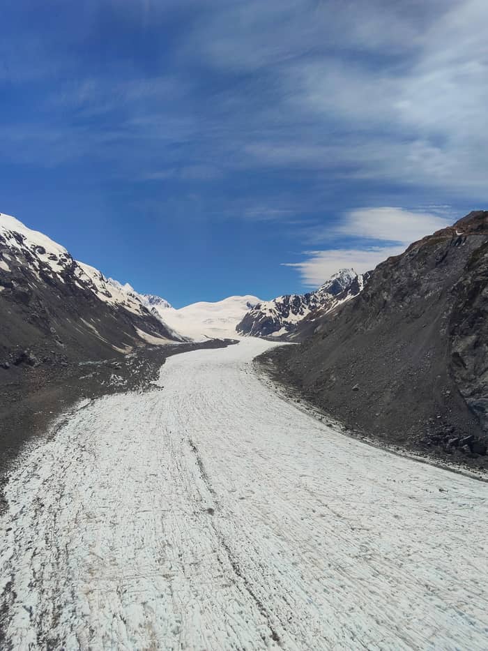
Main view
Moraine lookout
Above lake and glacier
- Return1.5 km
- Time30 min
- Effort300+ steps
Guides
Language
Currency
See open slotsfrom $528 · no cancel feeChoose your stop
The quick version
The Tasman Glacier View track is a free 1.5 km, 30-minute return walk with 300+ steps from Tasman Valley car park to a moraine lookout over Tasman Lake and the glacier, with a side trip to the Blue Lakes.
Walk essentials
View 15 stops
Pick a route, then tap a marker or a stop for notes and a Google Maps link.
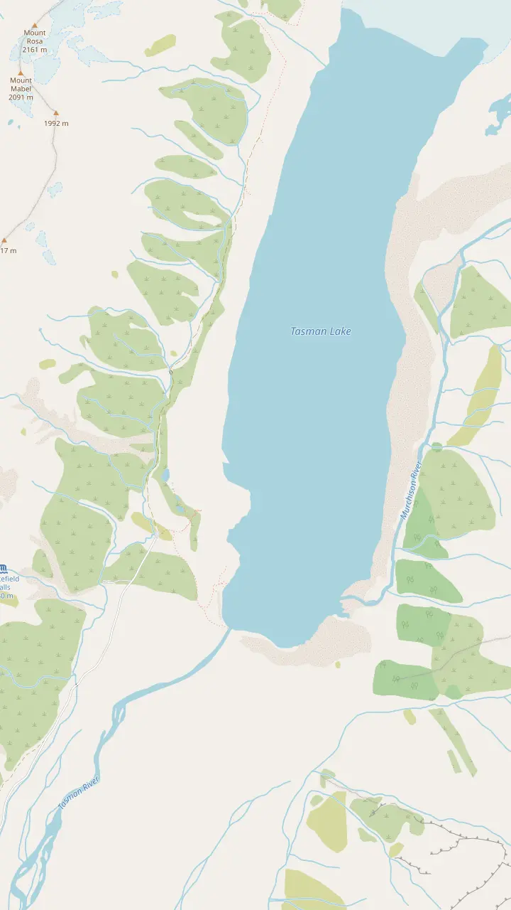
Free parking for cars and campervans at the end of Tasman Valley Road, about 7 km from SH80; it fills from November to April.
Google MapsSmall alpine lakes that were once blue with meltwater and now look green; a 5 min / 500 m side trip.
Google MapsThe lookout on the moraine wall after 300+ steps; 1.5 km and 30 min return from the car park.
Google MapsThe lakeshore lookout at the end of the Tasman Lake and River Track, 2.6 km and 50 min return.
Google MapsBegan forming in 1974; icebergs usually float here in summer and the surface freezes in winter.
Google Maps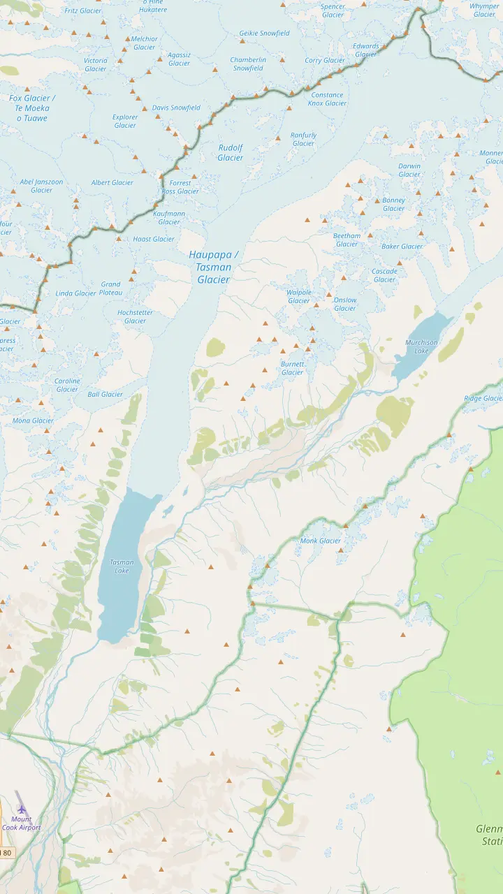
Free parking for cars and campervans at the end of Tasman Valley Road, about 7 km from SH80; it fills from November to April.
Google MapsThe lakeshore lookout at the end of the Tasman Lake and River Track, 2.6 km and 50 min return.
Google MapsBegan forming in 1974; icebergs usually float here in summer and the surface freezes in winter.
Google Maps23 km long, up to three km wide and 101 sq km, in DOC's figures.
Google MapsJoins the Tasman above the lake; near its icefall the Tasman ice is about 600 metres deep.
Google MapsA newer lake below the Murchison Glacier, whose lower ice NIWA saw breaking into separate trunks.
Google Maps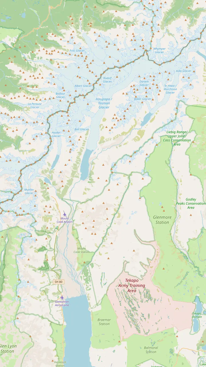
A separate airfield south of the village that visitors mix up with Mount Cook Airport.
Google MapsBase for the heli hike and the ski plane flights, 15 kilometres south of the summit; check-in closes 45 minutes before departure.
Google MapsDay shelter with toilets and showers, a visitor centre and a petrol station.
Google MapsOpen daily with free entrance; 8:30 am - 5 pm from October to April.
Google MapsThe DOC campsite, 15 min by car from the Tasman Valley car park.
Google MapsAt 3,724 m, the country's highest mountain.
Google Maps23 km long, up to three km wide and 101 sq km, in DOC's figures.
Google MapsThe highest landing of the guided ski runs, at 2,400 metres.
Google MapsBase map © OpenStreetMap contributors
The Tasman Glacier View track is the free way to look down on the glacier and its lake. Here is the walk step by step, the green Blue Lakes, the car park and the hours when the lookout is quiet.
Editorial team, tasmanglaciertour.com · Updated November 8, 2026 · Allow 8 min
DOC describes the Tasman Glacier View track as a short, steep climb that ends in panoramic views of Tasman Lake and the Haupapa/Tasman Glacier.9 It is 1.5 km return on the same track and takes about 30 min.1,2 DOC grades it an easy to intermediate walking track.10 Nothing about it is technical, but the stairs make it a real climb, and the reward at the top is out of all proportion to the effort.
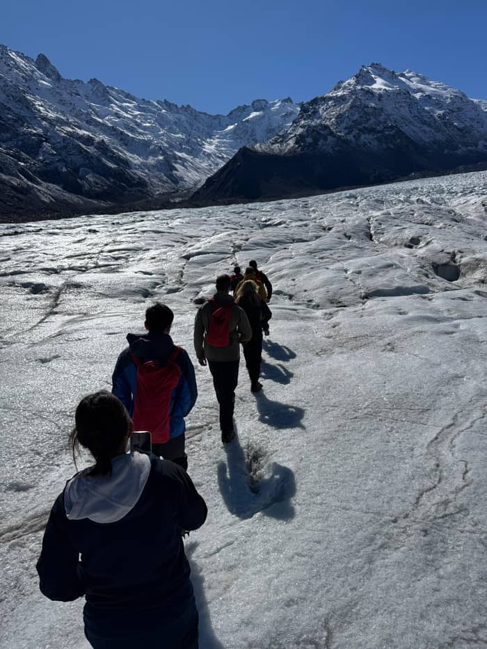
The lookout stands on top of a rocky wall of glacial debris, the moraine.11 From there you look across Tasman Lake to the glacier at its far end and, when the cloud is high, to Aoraki/Mount Cook and the snow-capped Southern Alps beyond.12 What surprises people is the colour of the ice: in its lower reaches the Tasman is covered with rock material, not white snow.13 The grey ridges you see beyond the water are glacier, buried under its own rubble.
The lake below is young. DOC states that Tasman Lake did not exist until 1974 and that it is growing rapidly as the glacier melts.14,15 In summer it carries icebergs and in winter it freezes over.16 The view is never quite the same twice: bergs drift from the ice face toward the outlet, the water changes from milky grey to steel blue with the light, and snow comes and goes on the peaks above.
Compare the walks
| Walk | Distance | Time | Good to know |
|---|---|---|---|
| Tasman Glacier View | 1.5 km return | 30 min return | 300+ steps |
| Tasman Lake and River | 2.6 km return | 50 min return | Rock steps, lakeshore view |
| Blue Lakes side trip | 500 m one way | 5 min one way | Green, rain-fed lakes |
| Boat tour jetty walk | 1.5km one way | 25 minutes | For boat passengers |
Distances and times as DOC and Mackenzie tourism give them; DOC's view track page lists the lake walk at 2.5 km.1,2,3,24,23,25,19,22
The walk begins at Tasman Valley car park, at the very end of the road.17 A signposted gravel track leads off toward the moraine, and the stairs start almost at once. After about 10 min of steady climbing the first of the Blue Lakes appears on your left.18 From there it is another 5 min up to the viewpoint.20 DOC counts 300+ steps between the car park and the top.3
The steps are uneven in places and the gradient is honest; take them at your own pace. You will find a bench partway up, but nowhere to sit at the top.21 Stop on the landings to catch your breath and look back down the valley toward Lake Pukaki. The lookout is a broad, rocky platform with no shade, which feels exposed when the wind funnels down the valley from the glacier.
You return the way you came. DOC's 30 min covers the walking itself, and the timing on the ground depends on how long you stand at the top.2 Allow longer if you want photographs, if you add the side trip to the Blue Lakes or if you plan to continue to the lakeshore on the second track. On a still morning the reflections on the lake can hold you at the lookout far longer than the walk took.
The Blue Lakes and Tasman Glacier walks share a start and much of their route. The Blue Lakes side trip is a 500 m, 5-minute detour off the main track to the nearest lake, where the path stops.19 It adds little effort to the outing, and it is a quieter corner of the valley when the main lookout is busy with tour groups.
The name tells an old story. DOC explains that the little lakes owed their old blue to glacial meltwater; today rain fills them and they look green.29,30 The glacier that once filled them with milky water has pulled back up the valley. Standing beside them, you are looking at a small, visible record of the same retreat that the big lake beyond the moraine shows on a much larger scale.
Keep your eyes open on the way. DOC notes that New Zealand's smallest bird, the rifleman or titipounamu, is sometimes seen around the Blue Lakes.28 Along the track grow speargrass or taramea, matagouri or tumatakuru and the mountain daisy, tikumu.31 Kea, the mountain parrot, may also turn up; DOC reminds visitors that kea are protected native birds and must never be fed.32
Pick your walk
Your time, your knees and how close you want to get decide it.
If I am short of time
The view track to the lookout
DOC's time is 30 min return.2
If Someone in my group avoids stairs
The lake and river track
DOC suggests it when steps are unsuitable.26
If I want to stand by the water
The lakeshore viewpoint
It finishes at a lookout right by the lake.27
If I want to stand on the ice
Book a heli hike
Up to 2 hours of guided walking on the glacier.
If I have no car
The Tekapo shuttle day
It includes a 45-minute walk at the viewpoint.
Three viewpoints
Main view
Above lake and glacier
Side trip
Small green alpine lakes
Fewer stairs
Down at the water
A second track takes you down to the water rather than up to the moraine. The Tasman Lake and River Track forks right from the Blue Lakes Track a little beyond the shelter there, ending at a lookout over the terminal lake.27 DOC's track page gives it as 2.6 km and 50 min return,24,23 while the view track page lists the same walk as 50 min and 2.5 km.25 A further branch leads to the source of the Tasman River.54
DOC suggests this route as a good alternative if steps are unsuitable for anyone in your group.26 It is not entirely flat: the surface is rock steps and the elevation changes by +/- 86 m.55,56 DOC rates the fitness required as low to moderate.57 The path winds across the glacier's former end moraines, and you can see plants recolonising the bare rubble in stages along the way.58
At the shore, the lake demands respect. Lake water here hovers around 3 degrees, DOC says, cold enough to bring on hypothermia fast.59 It also says never to climb icebergs, which are unstable and can tip without warning, and to stay off the lake when it is frozen, as the ice can be thin.60,61 DOC flags serious hazards both on the lake and on the moraine walls that ring it, and the marked viewpoints are the place to enjoy the view.62
Beyond the free walk
Compare the shuttle day with the viewpoint walk and the ways onto the ice.
Compare 3 side by side
Compare the shuttle day with the viewpoint walk and the ways onto the ice.
≈
View≈
View≈
ViewFrom-prices on GetYourGuide, shown at the ECB reference rate. Your exact price is confirmed during booking.
The walk
From Aoraki/Mount Cook Village, drive back down the highway toward Twizel. Take the second turning on the left, Tasman Valley Road, which comes after the Hooker Valley Road junction.63 Over the one-way bridge, keep going until the road ends at Tasman Valley car park.17 DOC puts the drive along Tasman Valley Road at about 7 km from the highway.33 The last stretch is gravel, and campervans manage it at a sensible speed.
DOC lists travel times by car of 10 min from the village, 50 min from Twizel and 1 hr 30 min from Tekapo.64 The Tasman Glacier car park offers free parking for cars and campervans, but it has no marked mobility spaces.5 It gets very busy in the summer season from November to April, and DOC asks drivers who find it full to park along Tasman Valley Road with care.34
Facilities are basic. The car park toilets shut over winter, and a dry summer can put them out of action too.7 There are picnic tables and a day shelter with seating.65 Drinking water is not available, and there are no rubbish bins.8,53 Mobile phones have no coverage here.66 Campers should know that wastewater cannot be disposed of in the park; the closest public dump station is in Twizel.67
Video
Long White Gypsy on YouTube · Until you tap play, no video is loaded.
New Zealand's smallest bird, rifleman/titipounamu, is sometimes seen around the Blue Lakes
Ready to walk
The track is busiest in the middle of the day in summer. DOC warns that it gets very crowded from November to April and that large tour groups use it.6,68 Early morning and early evening are calmer, and the low light gives the moraine and the peaks more shape. Winter brings a different scene, with lake ice instead of floating bergs, and snow can close SH80: check the road before you set out.16,69
Dress for the mountains, whatever the season. DOC reminds walkers that snow, freezing temperatures, strong winds and sunburn are all possible at any time of year.51 Its kit list for the walk is sturdy footwear, warm and waterproof clothing, and sun protection including sunscreen and a sun hat.50 Carry water, since none is available at the track, and a warm layer for the lookout, which catches the wind.8
A few rules keep the valley as it is. DOC bans drone flights without a permit,70 and recreational drones are banned throughout the national park.71 Tutu, a native shrub along the track, has poisonous black berries in summer, and children should be kept from picking them.72 Take all rubbish away with you, and leave the plants and stones where you found them.
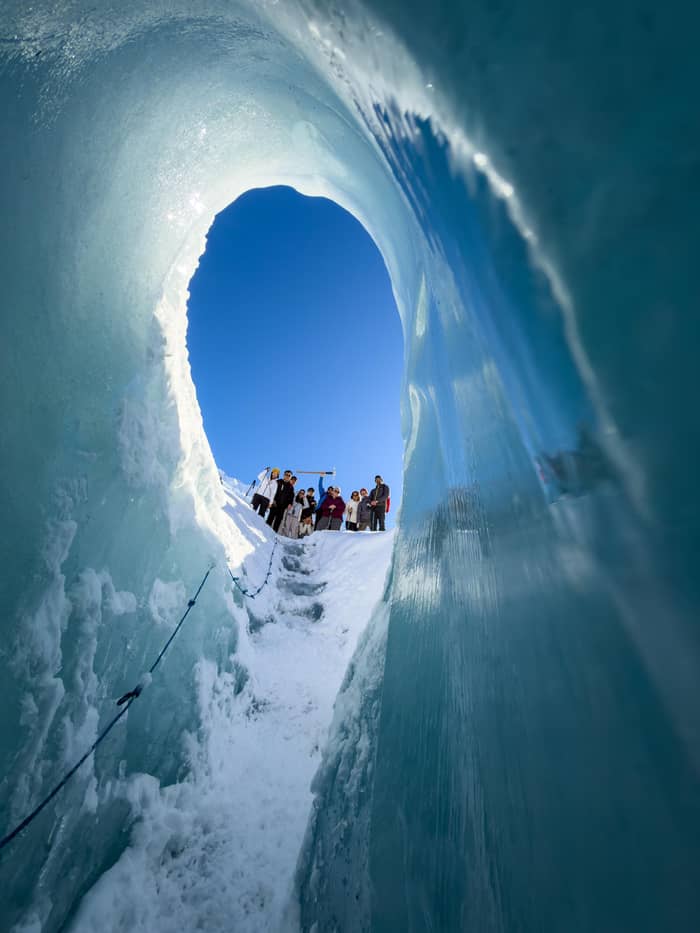
The Tasman Glacier viewpoint gives the overview, but it keeps you at a distance. Walking out onto the lake ice is not an option: DOC warns that walking on the ice could put your life at risk.52 To stand on the glacier itself safely you need a guide and a helicopter. The heli hike we sell flies you up from Mount Cook Airport for as long as 2 hours of guided walking on the glacier, from $528.
Without a car, a Tekapo shuttle does the driving: its 8.5-hour day includes 45 minutes at the Tasman Glacier Viewpoint plus 4 hours on the Hooker Valley Track, from $99. Bring your own lunch; the operator supplies water and snacks. You see the park's well-known walks in a single outing and leave the mountain roads to someone else.
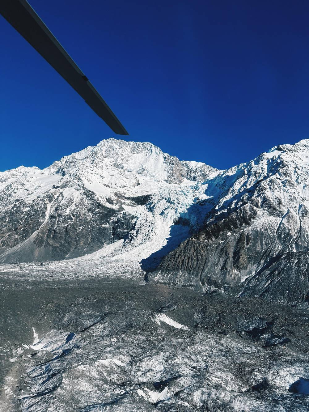
The walk also pairs well with the flying options. After a heli hike or a ski plane landing, climbing to the lookout shows you from the moraine wall where you have just been, which puts the size of the glacier into perspective. If cloud grounds the aircraft, the track is still worth doing, and the lake can look dramatic under a low, grey sky.
FAQ
DOC describes a steep climb with 300+ steps to the viewpoint.3
DOC states that bookings are not required for the track.4
They shut in winter and can be out of use in summer when water runs short.7
DOC strictly prohibits flying a drone without a permit.70
Sources
Read next
Wondering if the weather will let you fly onto the Tasman? Ask a real person here.