Top
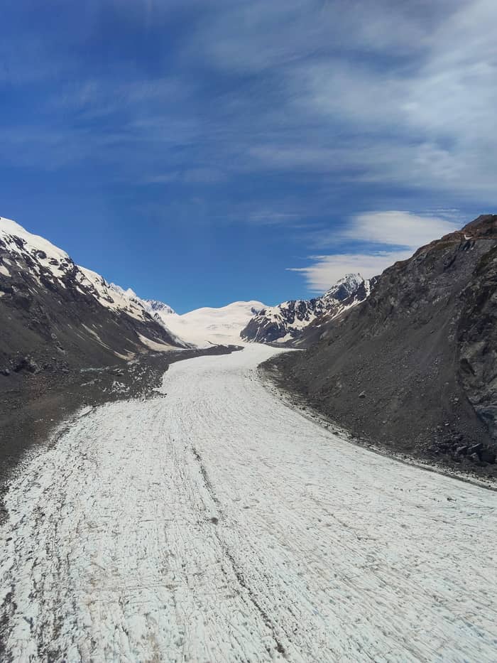
The upper snowfields
Where the glacier is fed
- Highest ski landing2,400 metres
- SnowfallUp to 12.5m
- TerrainChallenging
Guides
Language
Currency
See open slotsfrom $528 · no cancel feeDeciding made easy
The quick version
The Tasman Glacier is 23 km long with ice about 600 metres deep in places, and NIWA reports it has retreated an average of 180 metres per year since 1990 as its terminal lake grows and its tongue thins.
Retreat essentials
Two taps to the ice
Say how you want to meet the glacier and a matching listing appears with its from-price.
Best choice for you
from $528
It gives up to 2 hours on the ice with a guide, about 3 hours in all from Mount Cook Airport.
Best choice for you
from $555
It spends 2 hours hiking on the glacier in groups of up to 10.
Best choice for you
from $323
A 45-minute flight in two aircraft that lands on the Tasman Glacier.
Best choice for you
from $99
It includes a 45-minute walk at the Tasman Glacier Viewpoint and time for the Hooker Valley Track.
The Tasman Glacier retreat is written in rock, water and decades of aerial photographs. Here is how big the glacier is, how deep its ice runs, how fast it is pulling back and what the scientists who measure it expect.
Editorial team, tasmanglaciertour.com · Updated November 8, 2026 · Allow 8 min
Summary view
How long is the Tasman Glacier? DOC puts it at 23 km and calls it the longest glacier in New Zealand.1 Its park page describes it as both the largest and the longest, and adds that drivers can spot it from the main road at the park's gateway.6 The same page measures it at 23 km in length, as much as three km across and 101 sq km in area.2 Mackenzie tourism rounds the length to more than 23km.7
The glacier runs from high snowfields on the Main Divide down to its rubble-covered snout in Tasman Lake. At the top, the guided ski runs start from Tasman Saddle at 2,400 metres,8 and the heli hike lands around 1,200 metres above sea level on the white ice lower down, in Alpine Guides' figures.9 Between the two lie broad snowfields, icefalls and tributary glaciers that feed the main trunk from both sides of the valley.
The Tasman is the giant of a park built by ice. DOC says glaciers cover 40% of Aoraki/Mount Cook National Park.10 It names five major valley systems that shaped it: Godley, Murchison, Tasman, Hooker and Mueller.11 The park has 19 peaks over 3,000 metres,12 and their snow feeds the glaciers below. Seen from the air, the Tasman is the long central highway of that frozen network.
The Tasman in figures
| Measure | Figure | Source |
|---|---|---|
| Length | 23 km | DOC |
| Width | Up to three km | DOC |
| Area | 101 sq km | DOC |
| Ice depth | About 600 metres | DOC |
| Retreat since 1990 | 180 metres per year | NIWA, 2018 |
| Share of national ice | About a third | NIWA, 2017 |
| Lake length | 7 kilometers | NASA, 2017 |
Each figure exactly as its source states it; DOC figures are from its current park and track pages.1,2,3,4,5,27
How thick is the Tasman Glacier? DOC says the ice is about 600 metres deep near the Hochstetter Icefall.3 That icefall itself is a 1,000-metre-high cascade of broken ice, which Alpine Guides' heli hike passes on its return flight.18 Depth varies along the length of any glacier, and the figure DOC gives refers to the area near the icefall, where tributary ice pours into the main trunk.
Lower down, the glacier hides under rock. DOC notes that it is covered with rock material in its lower reaches.19 NIWA wrote in 2008 that the lower trunk of a long, low-gradient glacier such as the Tasman behaves as a creeping body of ice under a thick covering of insulating debris.20 NASA's Earth Observatory explains the effect: if the layer of dirt and debris is thick enough, it insulates the ice and slows melting.21
People who expect white ice are often surprised at the lookout: the grey hills beyond the lake are glacier under rubble. NIWA tried a thermal camera on its 2018 survey flight to learn more about the debris-covered ice.22 DOC's avalanche guidance draws the same line on the ground, rating the valley floor up to the start of the white ice as simple terrain and the upper glacier from the white ice as challenging.23,24
The headline figure comes from NIWA. Its Water & Atmosphere magazine of October 2018 puts the average retreat since 1990 at 180 metres per year.4 NASA's Earth Observatory, citing NIWA in 2017, gave the same rate for the 27 years between its 1990 and 2017 satellite images.31 An earlier NASA page reported NIWA's finding that by the end of 2007 the glacier had retreated five kilometers since 1976.15
The lake does most of the work. NIWA explained in 2008 that a glacier lake removes ice much faster than melting at the surface does, and that the feedback creates an irreversible tipping point.32,33 NASA, citing NIWA, reported that among the 12 largest glaciers, the Tasman included, 90 percent of the lost ice went through calving at the terminus or downwasting, the thinning of the surface by melt.34
The Tasman also runs on a slow clock. NIWA noted in 2008 that its response to snow gain is subdued and takes many decades longer than that of short, steep glaciers.35 In 2017 NIWA reported that between 1983 and 2008 no fewer than 58 New Zealand glaciers grew longer,36 yet the Tasman, holding about a third of the country's ice volume,5 had retreated five kilometers since 1976 by the end of 2007.15 It is still adjusting to decades of past change.
Three zones of one glacier
Top
Where the glacier is fed
Middle
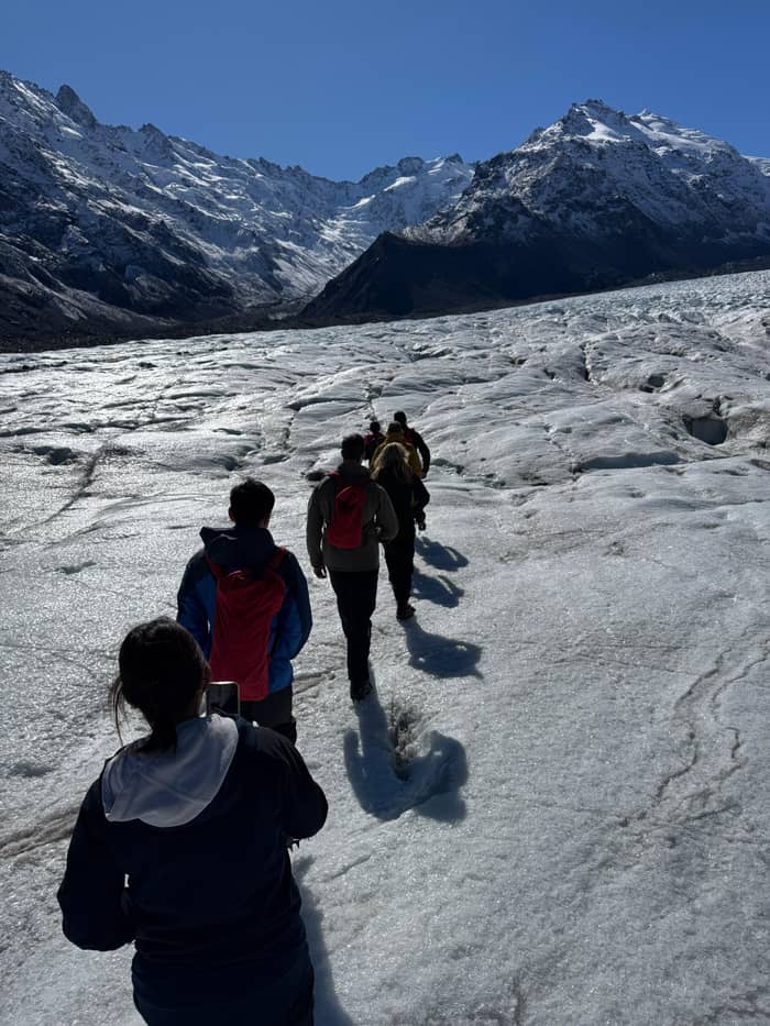
Where the heli hike lands
Bottom
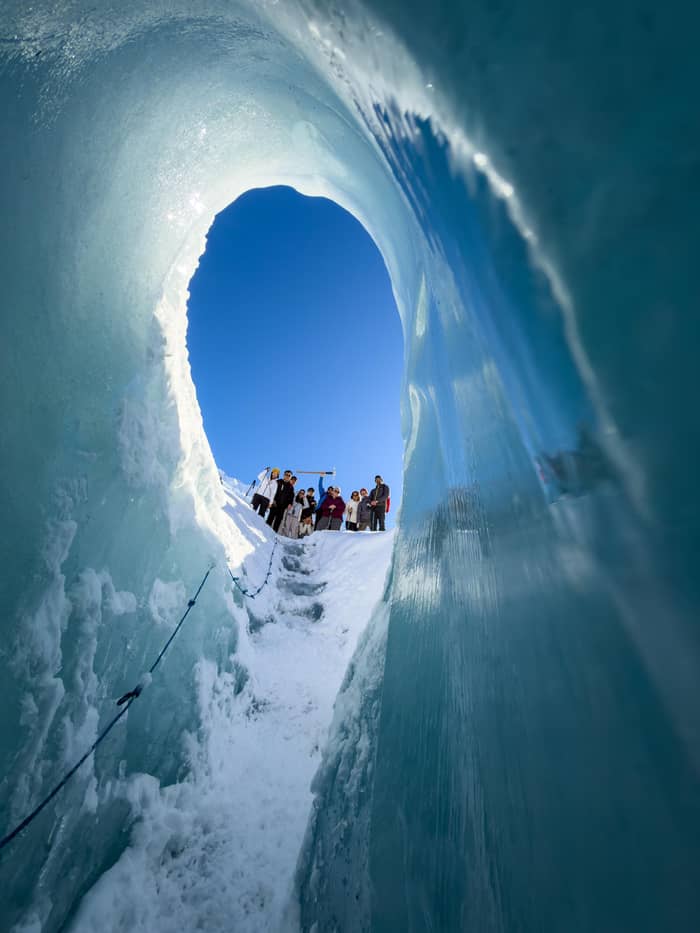
Where the lake bites
A visible sign of retreat is the water. There was no Tasman Lake before 1974, according to DOC.13 By 2017, NASA reported, it had swollen to 7 kilometers long.27 NIWA's 2008 assessment was that the lake would need to nearly double before the glacier could settle into balance with the climate.42 Each metre the lake gains along the valley is a metre the glacier has lost.
Sometimes the retreat happens in one go. On February 22, 2011, NASA reports, the magnitude 6.3 Christchurch earthquake shook a 30 million-ton slab of ice off the glacier's front.16 In NASA's view the quake simply finished off ice that was already on the point of breaking away.43 The lake had already undercut the front; the shaking only chose the day.
The retreat is not confined to the snout. NIWA's 2021 survey briefing described a temporary lake that kept filling and draining where the Hochstetter meets the Tasman, a possible trigger for more calving.44 The two glaciers still join above Tasman Lake, but NIWA expects cumulative ice loss to separate them eventually.45 Our page on the terminal lake covers the icebergs, the boats and the shoreline walks.
Before it changes again
Compare the heli hikes with a shorter flight that lands on the glacier.
Compare 3 side by side
Compare the heli hikes with a shorter flight that lands on the glacier.
≈
View≈
View≈
ViewFrom-prices on GetYourGuide, shown at the ECB reference rate. Your exact price is confirmed during booking.
Decades of retreat
1974
DOC dates the start of Tasman Lake to 1974.13
1977
NIWA's snowline survey began in 1977.14
1990
Average retreat of 180 metres per year since 1990.4
2007
By the end of 2007 the glacier had retreated five kilometers since 1976.15
2011
A 30 million-ton piece of ice broke off into the lake.16
2023
NIWA's 2023 flight found no reversal of the ice loss trend.17
Much of what is known comes from a light aircraft. NIWA's end-of-summer snowline survey began in 1977,14 and it is flown every March at the end of summer with specialised cameras.46 The 2023 survey was the 46th, a joint effort of NIWA, Victoria University of Wellington and DOC,47 and each year it photographs more than 50 glaciers of the Southern Alps at about the same date.48
The photographs add up to a national ice budget. NIWA's 2008 article reported that between 1976 and 2005 the ice volume of the Southern Alps dropped from 54.60 km3 to 48.74 km3, a loss of more than 10%.26 For the largest valley glaciers, only 0.49 km3 of the loss came from yearly mass balance, against 0.63 km3 from calving into lakes and 5.37 km3 from melting of their tongues and trunks.25 By 2021, NIWA put the overall loss at about 30% since surveying began.49
The latest reports offer no comfort. After the 2023 flight, NIWA said the observations did not suggest a reprieve or a reversal of the ice loss trend,17 and that some index glaciers had been abandoned because their snowlines and meaningful ice had disappeared.50 Scientists have also linked warm seas to bad years: a warmer than usual Tasman Sea tends to mean heavy losses of snow and ice in the Southern Alps.51
Video
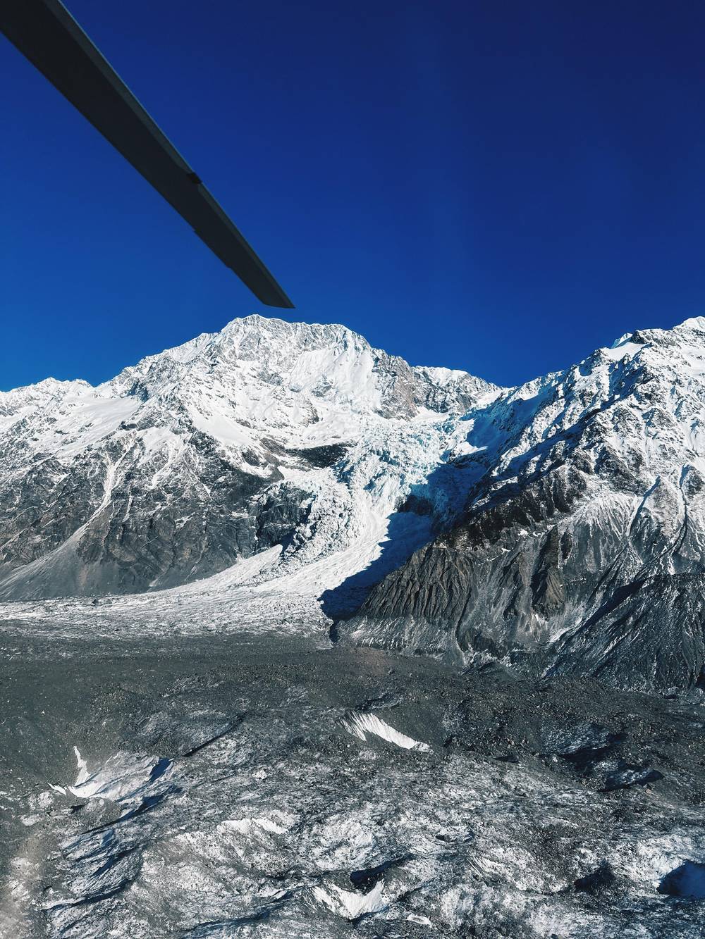
ENLIGHTENMENT on YouTube · Until you tap play, no video is loaded.
This year’s observations do not suggest a reprieve or a reversal of the ongoing ice loss trend
Reading the landscape
DOC writes the glacier's name as Haupapa/Tasman Glacier, with the Maori name first.28 You will see the dual name on DOC signs, maps and track pages across the park, as with Aoraki/Mount Cook itself. The guiding company notes that the English name honours the Dutch explorer Abel Tasman, the first European to sight New Zealand, in 1642.52 We have not found an official explanation of the name Haupapa that we can quote, and we do not offer one.
The mountains around the glacier carry deep meaning for Ngai Tahu, the iwi of the region. DOC explains that Ngai Tahu regard Aoraki as their most sacred ancestor.53 It also notes that, for Ngai Tahu, waste left in the park is unacceptable, since the waters flowing from Aoraki are sacred.40 Visitors honour that by carrying out every scrap of rubbish and by treating the valley as a place of significance, not only of scenery.
The landscape also carries international recognition. DOC notes that the park forms part of Te Waipounamu, the South Westland World Heritage Area.54 Its glaciers have shaped the region for a very long time: Alpine Guides describes the Tasman advancing and retreating several times, leaving great moraine deposits and carving out Lake Pukaki.55 The present retreat is the latest chapter of a long story, but a fast one.
No official body gives a date. What the scientists offer is a direction. Speaking through NIWA in 2017, the lead author of a glacier study said that if warming reaches the two to four degrees expected by the century's end, New Zealand's glaciers will mostly be gone.56 On the evidence above, it is the lower glacier that is losing ice fastest, while the high snowfields are still fed.
The top of the glacier is still well fed. NIWA notes that median annual temperatures below 2°C along the main divide around Mt Cook sustain the perennial snow and glaciers at high elevations.57 The guiding company says up to 12.5m of snow can fall at the top of the glacier in spring and winter.58 The upper Tasman will remain a place of deep snow for a long time; it is the lower glacier, and the long tongue visitors see from the lookout, that is shrinking.
For a visitor, that has a practical meaning. The lake grows, the walks to the shore change and the landing sites on the ice move from season to season. If you want to stand on the Tasman while its white ice is within reach of a short helicopter hop, our heli hike puts you on it with a guide for up to 2 hours, from $528. The free lookout shows the same story from the moraine wall.
FAQ
DOC gives 23 km and calls it the longest glacier in New Zealand.1
DOC says the ice is about 600 metres deep near the Hochstetter Icefall.3
NIWA's 2018 figure is 180 metres per year on average, counted from 1990.4
In 2017 NIWA credited the Tasman with about a third of the nation's glacier ice.5
DOC uses the dual name Haupapa/Tasman Glacier; we have not found an official explanation to quote.28
The 2023 snowline survey was the 46th, run by NIWA, Victoria University of Wellington and DOC.47
Sources
Read next
Wondering if the weather will let you fly onto the Tasman? Ask a real person here.