On the water
Among the bergs
Guided boat on the lake
- SeasonSeptember to June
- Walk to jetty25 minutes
- StartsHermitage Hotel
Guides
Language
Currency
See open slotsfrom $528 · no cancel feeChoose your stop
The quick version
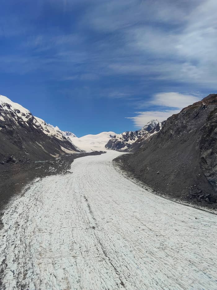
Tasman Lake is the Tasman Glacier's terminal lake: it began forming in 1974, had reached 7 kilometers long by 2017, carries icebergs in summer, freezes in winter and holds water of about 3 degrees.
Lake essentials
View 15 stops
Pick a route, then tap a marker or a stop for notes and a Google Maps link.
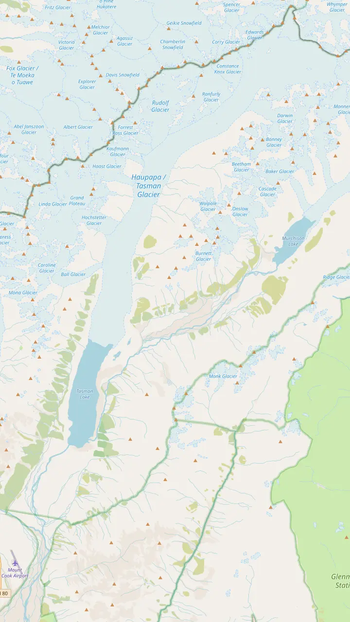
Free parking for cars and campervans at the end of Tasman Valley Road, about 7 km from SH80; it fills from November to April.
Google MapsThe lakeshore lookout at the end of the Tasman Lake and River Track, 2.6 km and 50 min return.
Google MapsBegan forming in 1974; icebergs usually float here in summer and the surface freezes in winter.
Google Maps23 km long, up to three km wide and 101 sq km, in DOC's figures.
Google MapsJoins the Tasman above the lake; near its icefall the Tasman ice is about 600 metres deep.
Google MapsA newer lake below the Murchison Glacier, whose lower ice NIWA saw breaking into separate trunks.
Google Maps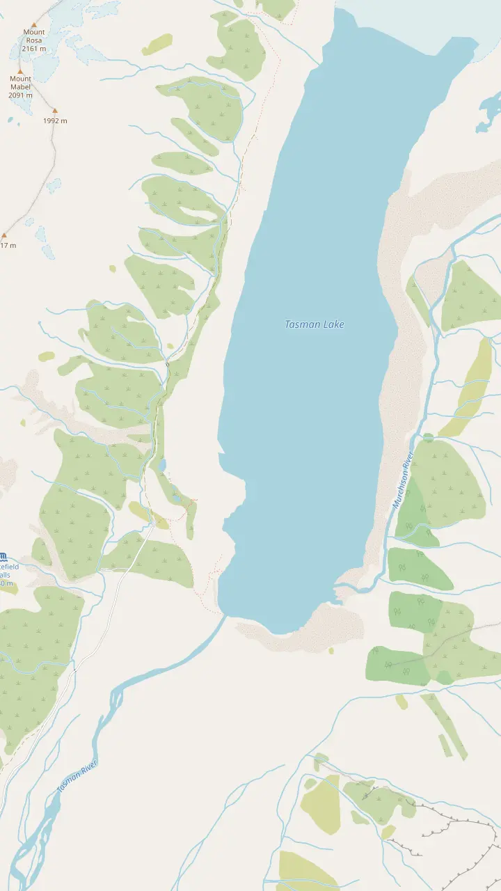
Free parking for cars and campervans at the end of Tasman Valley Road, about 7 km from SH80; it fills from November to April.
Google MapsSmall alpine lakes that were once blue with meltwater and now look green; a 5 min / 500 m side trip.
Google MapsThe lookout on the moraine wall after 300+ steps; 1.5 km and 30 min return from the car park.
Google MapsThe lakeshore lookout at the end of the Tasman Lake and River Track, 2.6 km and 50 min return.
Google MapsBegan forming in 1974; icebergs usually float here in summer and the surface freezes in winter.
Google Maps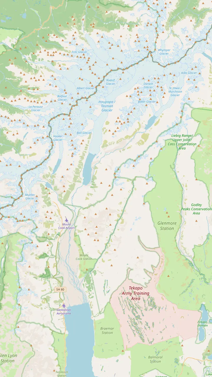
A separate airfield south of the village that visitors mix up with Mount Cook Airport.
Google MapsBase for the heli hike and the ski plane flights, 15 kilometres south of the summit; check-in closes 45 minutes before departure.
Google MapsDay shelter with toilets and showers, a visitor centre and a petrol station.
Google MapsOpen daily with free entrance; 8:30 am - 5 pm from October to April.
Google MapsThe DOC campsite, 15 min by car from the Tasman Valley car park.
Google MapsAt 3,724 m, the country's highest mountain.
Google Maps23 km long, up to three km wide and 101 sq km, in DOC's figures.
Google MapsThe highest landing of the guided ski runs, at 2,400 metres.
Google MapsBase map © OpenStreetMap contributors
The Tasman Glacier lake is a newcomer to the valley. Here is how it formed, where its icebergs come from, how to get onto or beside the water, and what its growth says about the glacier.
Editorial team, tasmanglaciertour.com · Updated November 8, 2026 · Allow 8 min
Tasman Lake fills the lower Tasman Valley between the glacier's ice face and the moraine walls that once held its snout. DOC says it started forming in 1974 and has grown steadily since then.1 NIWA's Water & Atmosphere magazine of October 2018 and NASA's Earth Observatory both put the line a year earlier: before 1973, they say, the lake did not exist.6,7 The sources differ on the year, not on the story.
A lake at the front of a glacier changes how it melts. Once a lake has formed, NIWA explained in 2008, it eats at the glacier far faster than surface melt.8 NIWA scientists, quoted by NASA, added that a lake at the snout makes it more likely that blocks of ice will break away.9 The water is both a product of the retreat and an engine of it: the water undercuts the ice face, slabs fall in, and the lake moves one step further up the valley.
Its size tells the same story. By 2017, NASA reported, the lake had swollen to 7 kilometers long within a decade.2 NIWA wrote in 2008 that Tasman Lake still had to almost double in size before the glacier would shrink enough to reach equilibrium with the climate.10 DOC's walking pages describe it as growing rapidly as the glacier melts.11 Anyone who returns after a few years sees a different shoreline.
Lake seasons
| When | On the lake | Boat tour | Watch for |
|---|---|---|---|
| Summer | Icebergs usually afloat | Running | Crowded tracks and car park |
| Winter | Frozen over | Paused after June | Thin ice, snow on SH80 |
| Any season | Water near 3 degrees | Weather permitting | Wind, sunburn, snow |
From DOC's track pages and Mackenzie tourism's boat tour listing.3,23,5,24,25,4,26
Tasman Glacier icebergs are pieces of the glacier's front that have broken away into the lake, a process called calving. DOC says summer is when you can usually expect bergs drifting on the lake.3 Their size varies widely, and Mackenzie tourism describes boats weaving in and out of icebergs of all sizes.15 Wind and the current toward the outlet push them around the lake from day to day.
The most famous calving came with the Christchurch earthquake. NASA reports that the magnitude 6.3 quake of February 22, 2011 tore a 30 million-ton block from the glacier's front.13 It shattered into a fleet of smaller bergs as it hit the water,16 and by March 2 satellite images showed them gathered at the far end.17 NASA's reading was that the quake only provided the final pulse of energy to ice that was about to break off anyway.18
Icebergs here come in more colours than white. Ice that has turned over shows smooth, glassy blue undersides; ice from the rock-covered lower glacier can be streaked or almost black with debris; fresh breaks look chalky. All of them are unstable. DOC warns visitors never to climb icebergs in the lakes, as they can tip unexpectedly.19 Even from a boat, guides keep a careful distance from large bergs and from the ice face.
For anyone who wants to be out among the bergs, the way onto the lake is a guided boat trip. Mackenzie tourism calls Glacier Explorers New Zealand's only glacial boat tour.30 Its season runs from September to June, and trips leave from the Hermitage Hotel in the village.5 The trip includes a 1.5km walk from the Blue Lakes car park to the jetty, which guests should cover in about 25 minutes.22 Our lake boat page covers prices and booking in detail.
Out on the water, the boats cross Tasman Lake to view the glacier's ice face from a safe distance and weave among the icebergs.15 From lake level the scale reads differently than from the moraine lookout: bergs that looked like white dots become cliffs of ice, and the grey glacier front turns out to be a wall many storeys high. Dress warmly. Wind off the ice chills a boat far faster than it chills the walking track.
The boat season reflects the lake's year. DOC notes that the lake freezes over in winter,3 and the boat season ends in June and restarts in September.5 Book a morning trip if you can: calmer water gives sharper reflections and a gentler ride. In the heart of summer the jetty walk and the car park both get busy, and an early start keeps the lake quieter for you.
Plan your lake visit
Season, budget and how close you want to be decide it.
If I want to be among the icebergs
The boat tour, September to June
Boats weave among icebergs of all sizes.15
If I want a free look at the water
The lake and river track
Its end point overlooks the lake from the shore.27
If I want lake and glacier in one view
The moraine lookout
The view track looks over the lake to the glacier.28
If I am visiting in winter
Walk to the frozen lake, stay off it
DOC warns the ice can be thin.24
If I want to stand on the glacier itself
Book a heli hike
A guide leads you on the ice for up to 2 hours.
Three ways to meet the lake
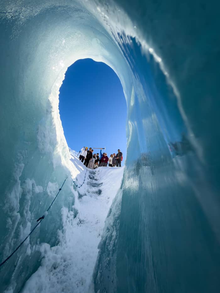
On the water
Guided boat on the lake
On foot
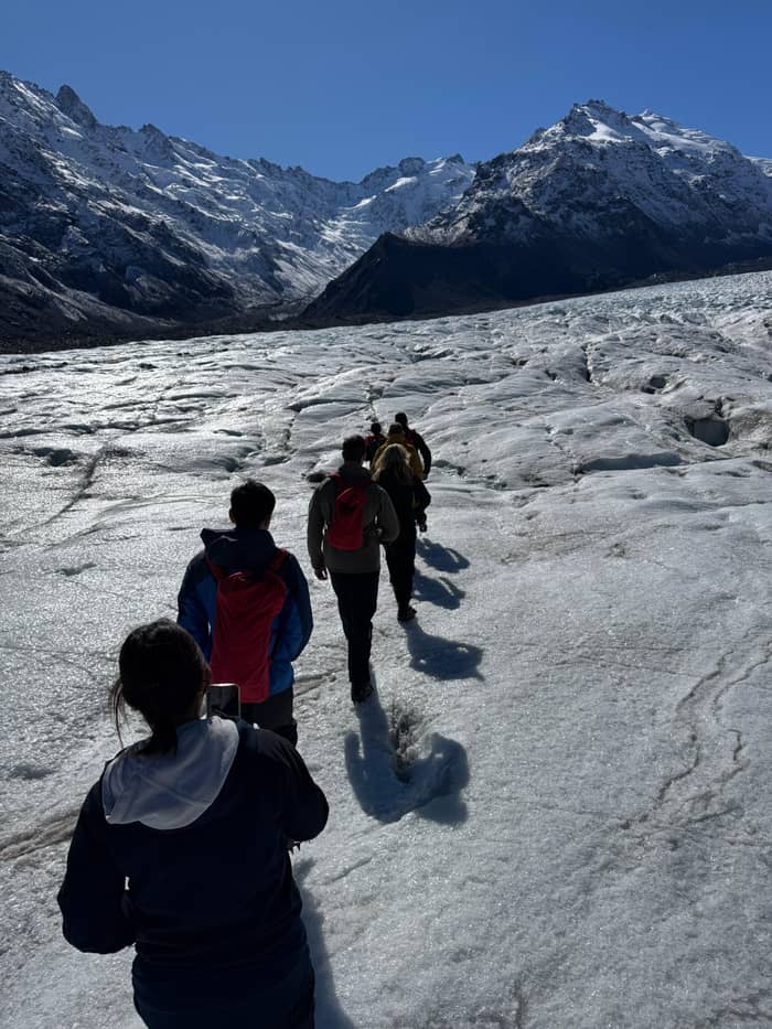
Free walk to the water
From the air
Helicopter to the ice
The lake has grown big enough, DOC says, for commercial boat and kayak trips.56 A Tasman Glacier kayak trip puts you at the waterline among the bergs, closer to the ice than any lookout and with no engine noise. Treat paddling here as a guided activity, not something to try in your own craft: the conditions change quickly, the shore is loose moraine and help is far away. Ask any operator about wetsuits, group size and the rules for distance from icebergs.
Swimming is out of the question. DOC puts the usual water temperature of the Hooker and Tasman lakes at about 3 degrees, warning of rapid hypothermia.4 That is close to the temperature of a household fridge. A fall from a kayak is an emergency; guides keep groups together and close to safe landings. Leave the idea of a quick dip for warmer lakes further down the Mackenzie Basin.
Winter brings a different danger. DOC asks visitors to keep off frozen lakes: the ice may be thin and can collapse without warning.24 DOC also flags the lake and its ring of rock walls as hazardous for anyone venturing past the viewpoint.55 The moraine is loose rubble that slumps toward the water, and the shoreline you see this year may not be there next year.
See it from above
Compare the heli hike with the shorter flights that land on snow.
Compare 3 side by side
Compare the heli hike with the shorter flights that land on snow.
≈
View≈
View≈
ViewFrom-prices on GetYourGuide, shown at the ECB reference rate. Your exact price is confirmed during booking.
How the lake grew
1973
1974
DOC dates the start of the lake to 1974.1
1990
NIWA: retreat averaging 180 metres per year from 1990.12
2011
A 30 million-ton piece of ice fell into the lake.13
2017
NASA: the lake had swollen to 7 kilometers long.2
2021
NIWA watched a lake forming and draining at the Hochstetter junction.14
The free way to the Tasman Glacier terminal lake is on foot from Tasman Valley car park. Follow the Blue Lakes Track briefly, then fork right after the shelter onto the Tasman Lake and River Track, which ends at a lookout over the water.27 The round trip is 2.6 km and takes about 50 min, in DOC's figures.21,41 Another fork heads to the point where the Tasman River leaves the lake and spills into its braided bed.57
The higher view is on the Tasman Glacier View track, which climbs the moraine wall to a lookout over the whole lake: 1.5 km and 30 min return.39,40 From the top you see the lake with the glacier at its far end, which makes it easy to understand how they fit together.28 From the shore you see the bergs up close and hear the water lapping the gravel. If you have the time, do both on the same visit.
The lake track crosses the ridges of rubble the glacier left at its old snout, where plants are slowly taking hold.58 DOC describes these large moraines as marking the foot of the glacier at the time the lake formed, and as a sobering reminder of its retreat.29 Standing on them and looking up the lake to the distant ice face is a direct way to feel how far the Tasman has pulled back in a single human lifetime.
Video
RNZ on YouTube · Until you tap play, no video is loaded.
The large terminal moraines mark the foot of the Haupapa/Tasman Glacier at the time of the lake's formation and are a sobering reminder of the glacier's retreat
Safe by the lake
Summer is the season of icebergs. DOC says they can usually be seen floating in the lake at that time, and the view track page lists icebergs in summer and lake ice in winter as its seasonal pictures.3,59 It is also peak season on land, with DOC describing the walking track as very busy between November and April.23 Boats run through the summer and into autumn.5
Winter turns the lake white. The surface freezes over, the boats pause after June and the valley quietens.3,5 Snow can close SH80, and the car park toilets shut for the winter, which matters on a long visit.25,60 On a clear, still winter day the frozen lake below the snowy peaks is a striking sight, and you may have it almost to yourself.
Spring and autumn are transitions. In spring the frozen surface gives way to open water again, and the boats return in September.5 Weather can change quickly in any month, and DOC lists snow, frost, gales and sunburn among the risks in every season.26 Bring warm layers and a windproof jacket whatever the calendar says, and check the forecast before you walk or sail.
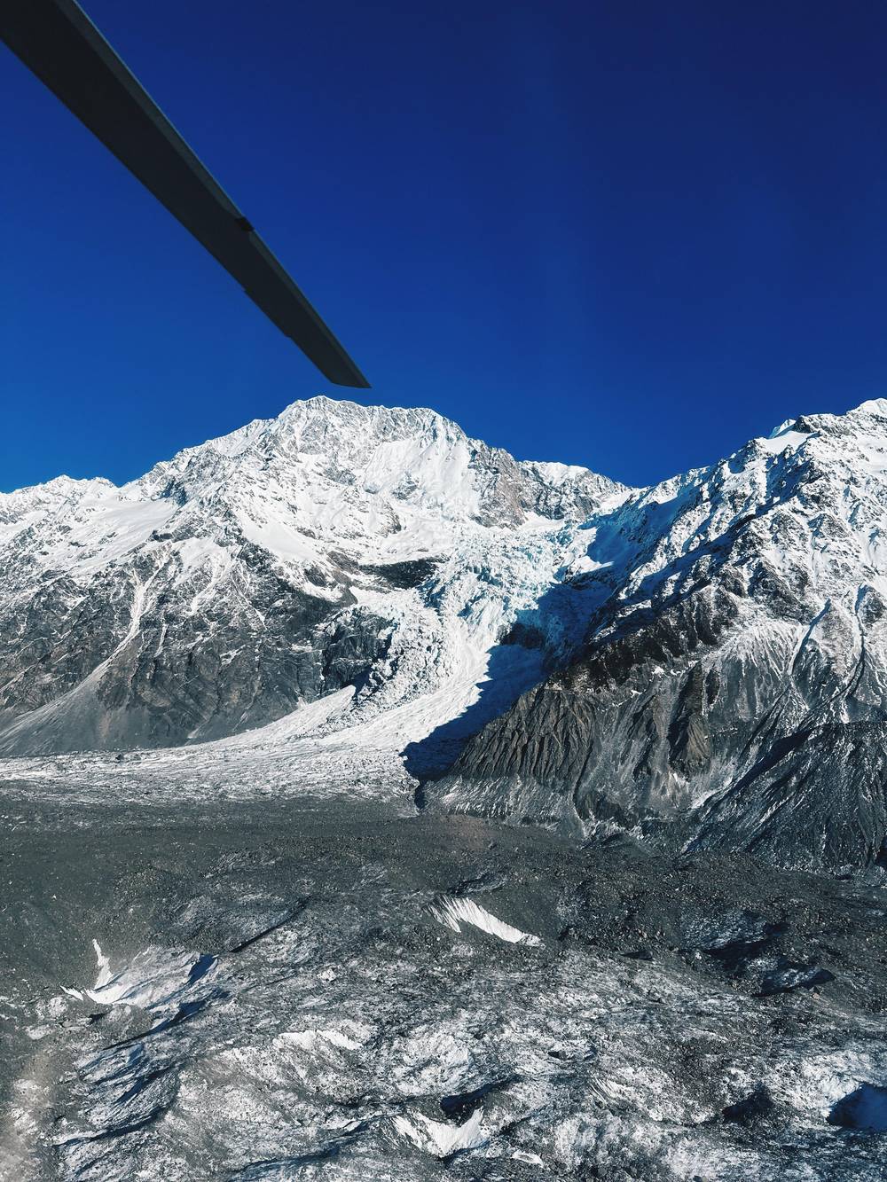
From the air the lake becomes a map. Our heli hike's helicopter crosses the valley on its way up, and the trip keeps you on the glacier with a guide for as long as 2 hours, from $528. A ski plane and helicopter combination flight of 45 minutes lands on the Tasman Glacier, from $323. Both show the line where the grey, rock-covered ice ends in the water.
Higher up, scientists are watching another lake. In March 2021 NIWA described a lake that kept appearing and vanishing where the Tasman and Hochstetter glaciers meet.14 NIWA suspected that it built to a certain size and was then siphoned away, possibly under the Hochstetter Glacier, into Tasman Lake.61 The two glaciers still join above the lake, but NIWA expects ice loss to separate them eventually.43
Downstream, the lake's water has a long life. NASA notes that the glacier's water ends up in Lake Pukaki, a storage lake for hydroelectric power.62 On the way it spreads across the braided bed of the Tasman River, where DOC says the kaki, or black stilt, lives, a bird it counts among the country's rarest.63 The milky turquoise of Lake Pukaki that travellers photograph from the highway starts here.
FAQ
NASA reported in 2017 that the lake had swollen to 7 kilometers long.2
DOC says icebergs can usually be seen in summer and that the lake freezes over in winter.3
At about 3 degrees, DOC warns, the water quickly brings on hypothermia.4
Mackenzie tourism says Glacier Explorers runs from September to June, departing from the Hermitage Hotel.5
DOC warns that frozen lake ice may be thin and give way suddenly.24
According to NASA, the quake of February 22, 2011 dropped a 30 million-ton mass of ice from the glacier.13
Sources
Read next
Wondering if the weather will let you fly onto the Tasman? Ask a real person here.